


The Case
For years, tracking cell phone usage and location information has helped law enforcement put offenders behind bars. Often, this analysis is very time-consuming, taking many hours to create hand-drawn link charts and paper maps.
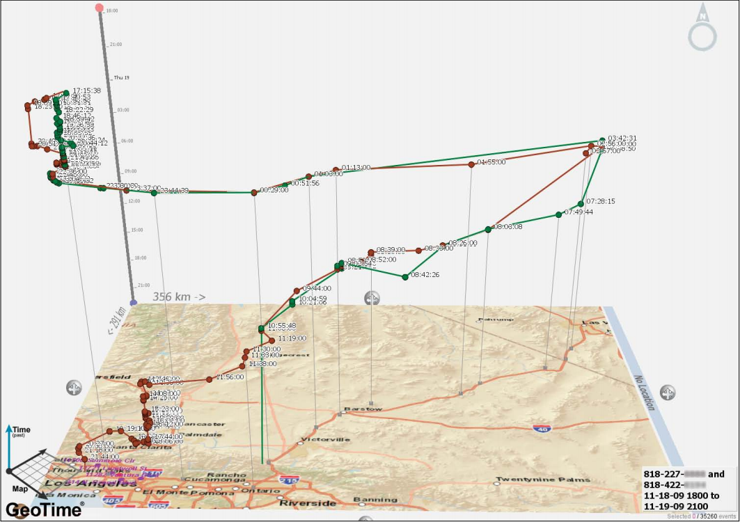
The Challenge
On two-dimensional maps, it was particularly difficult to clearly see multiple cell tower hits in the same location over a period of time. One dot appears where, in fact, there are multiple calls. It was clear that analysts needed a solution to include time variables within its maps.
How GeoTime Helped
GeoTime provided LA CLEAR with a unique 3D time viewer to simultaneously visualize geospatial, temporal, and link data. Now, analysts can plot critical events onto situational maps for ongoing surveillance on active cases, or analyze call detail records, gang activity or illegal drug transportation.
Analysts can now process in seconds what used to take days.
GeoTime Features Used
- Data layering – including GPS tracking data and cell phone records
- Video and PowerPoint presentations
The Result
Analysts were able to better manage and interpret larger datasets with more efficiency. This allowed officials to make faster, more accurate decisions by identifying where suspects had been and where they were headed.
"We were limited to two-dimensional views of cell tower hits. Deputy district attorneys were asking us for something that could express both time and space for their court presentations."
“We can see if multiple cell phones meet before or after a crime to, say, deliver or hand off a weapon. We can also display all this movement in a video that dramatically increases viewers’ understanding of what they are looking at.”
-Toni Nunez, senior lead analyst, LA CLEAR
Full Story